
Melrose Park ZIP Coverage Guide
Official Melrose Park material uses several ZIP labels, but only 60160 is firmly documented as the core postal code across Village Hall, police, library, and post office sources. The other codes need address-level context. A mail-container assignment is not a city boundary, and an organizational PO box does not establish the coverage of street delivery.
| ZIP | Areas or Examples | Post Office Evidence | Notes |
|---|---|---|---|
| 60160 | Core Melrose Park; most village offices | Melrose Park station and USPS label | Strongest core code; exact address controls |
| 60161 | Local PO box example | Melrose Park label scheme | Service code, not proof of village limits |
| 60162 | Hillside edge | Historically grouped with Hillside | Verify every street address |
| 60163 | Hillside and nearby geography | Current container routes through Melrose Park | Not a core village ZIP without exact proof |
| 60164 | Westdale Park District and Northlake overlap | Melrose Park container | Postal label and municipality may differ |
| 60165 | Stone Park and regional edge | Grouped in Melrose Park handling | Do not infer village residence |
| 60171 | River Grove | Separate River Grove label | Adjacent, not a Melrose Park ZIP |
The table is a verification map, not a list of residents. The Village's use of 60164 for Westdale Park District and 60161 for a Little League PO box proves that local services can use codes beyond 60160. It does not draw their delivery polygons.
Verify Melrose Park Postal Labels
The USPS ZIP Code Lookup is the controlling source for one current delivery address. It offers three routes: address to ZIP, city and state to a list of ZIPs, and ZIP to recognized cities. In address mode, company is optional; street address is required; apartment, suite, or other unit is optional; city and state identify the locality; and ZIP can be supplied for confirmation.
| Mode | Fields | Best Use |
|---|---|---|
| By Address | Company, street, unit, city, state, ZIP | Confirm one standardized delivery address |
| By City and State | City and state | See ZIP labels recognized for a city name |
| Cities by ZIP | ZIP | Check preferred and recognized city labels |
Open the USPS AIS Viewer for current ZIP and county reference data.
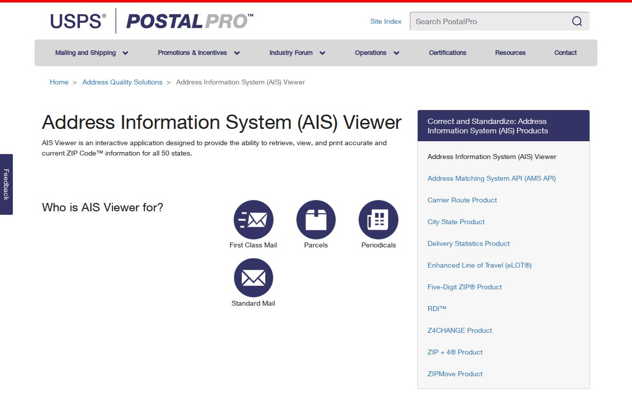
The monthly AIS reference helps confirm ZIP, county, ZIP+4, and address quality. USPS also warns that a valid address result does not confirm that a named person or company occupies it.
Melrose Park Mail Container Myth
A 2026 USPS processing table sends destination ZIPs 60160 through 60165 to a MELROSE PARK IL 60160 label container. That phrase describes mail handling. It does not mean every address in all six ZIPs lies within Melrose Park or uses Melrose Park as its preferred postal city. An older 2001 scheme provides useful history: it grouped 60160, 60161, and 60165 with Melrose Park, while 60162 and 60163 appeared with Hillside.
Use the historical grouping only as a clue. Current exact-address results govern mail. Village boundaries require municipal or Census boundary data, and a taxable parcel requires its Cook County PIN and legal description. Combining these three checks avoids a common ZIP code directory error.
Search Melrose Park Parcels by ZIP
The Cook County Property Tax Portal accepts a 14-digit PIN or an address made from house number, street, unit, city, and ZIP. A result can lead to a five-year billed-tax summary and recorded-document links. That makes the portal useful after a ZIP has narrowed the area, but it returns property information, not a directory of every person in that postal code.
Review the ZIP-capable Cook County property search.
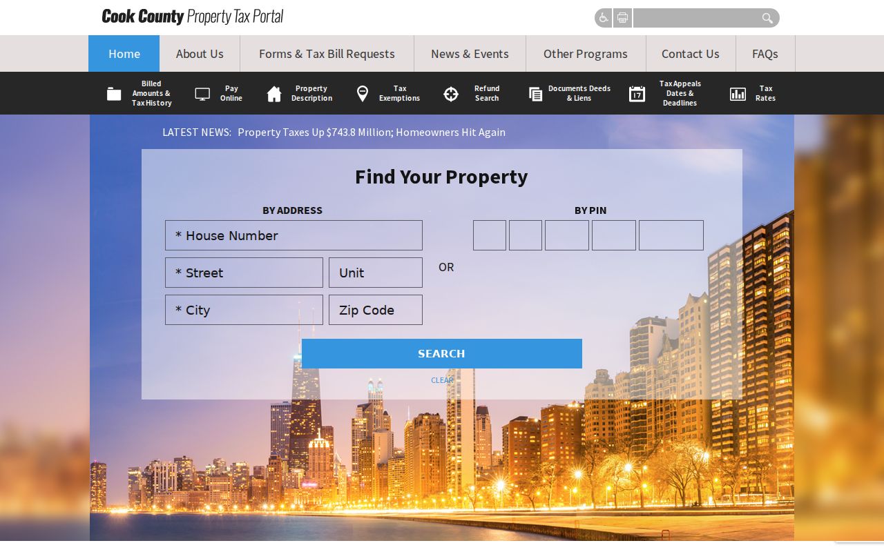
The screen supports an exact-address workflow. It should not be described as a ZIP-wide resident export, and a taxpayer mailing address must remain separate from the situs parcel address.
The Cook County Assessor also accepts address and PIN searches. Its neighborhood route can use township, neighborhood, and property class, though the captured research did not expose all option lists. CookViewer adds parcel, PIN, address, intersection, historical layers, and nearby parcel tools. None turns a postal ZIP into proof of residence.
Find Melrose Park Residents by ZIP
A careful ZIP code directory search goes from broad postal geography to a specific, independently confirmed record. Start with the smallest trustworthy detail. If the only fact is a ZIP, use a city or street name before drawing any connection to Melrose Park.
- Enter the full street address and unit in USPS ZIP Lookup. Save the standardized city and ZIP result.
- Use the same address in the Cook Property Tax Portal or Assessor. Record the PIN, situs municipality, tax year, and mailing address separately.
- Open CookViewer when the parcel sits near Maywood, Stone Park, Bellwood, Hillside, Berkeley, River Grove, or Northlake. Compare the mapped jurisdiction and nearby roads.
- Use a name only after the postal and parcel locations agree. Confirm the person through a lawful official record with a matching date.
Once a ZIP narrows the search to a named road, the Melrose Park street directory gives the street-level record sequence. Illinois voter data is regulated and no public portal was verified that exports all residents of a ZIP. Do not present registration counts or address-by-district files as a public resident roster.
Melrose Park ZIP Geography
North Avenue, Lake Street, Broadway, 25th Avenue, and the Des Plaines River area give useful geographic anchors. The village sits among Maywood, Stone Park, Bellwood, Hillside, Berkeley, River Grove, and Northlake. Those close borders explain why the same regional search can return a Melrose Park postal label, an adjacent municipality, and a Cook County parcel jurisdiction that need to be reconciled.
Census QuickFacts reports 4.35 square miles of Melrose Park land and separates the 2020 population count of 24,796 from the 2025 estimate of 23,936. Those figures show a compact, dense village, but they do not provide per-ZIP resident totals. No official Melrose Park ZIP-specific population or registration count was confirmed in the research. Do not divide village totals among postal codes without an authoritative crosswalk.
For an edge address, compare the USPS result, the Cook PIN, the parcel's municipality, and a current municipal boundary source. Keep the wording that appears on each record. A postal label can be correct for mail while a different municipality is correct for civic services.
Older Melrose Park Address Labels
Historical records add another place-name problem. Newberry files the documented 1917 and 1920 through 1927 Maywood and Melrose Park city directory runs under Maywood. A person may therefore appear beneath Maywood in a directory while a deed, census sheet, newspaper, or later postal record uses Melrose Park. Search both place names before deciding that a resident is absent.
Reverse or criss-cross directories, which arrange entries by street and number, can connect an old address to a person. Exact local reverse-run years were not confirmed. Pair directory leads with census enumeration districts, the 1895 or 1909 Sanborn material, deeds, newspapers, and Cook IRAD maps. No authoritative Melrose Park street-renumbering crosswalk was located, so never invent a modern equivalent for an old number.
A PIN and legal description are often more durable than the postal wording. The ZIP code directory is strongest for present mail validation; older resident research must preserve the source's original city label and bridge it with maps and parcel records.
Melrose Park ZIP Boundary Limits
ZIP areas are built for delivery, while village boundaries control municipal jurisdiction and parcel records follow legal land descriptions. That mismatch is normal. It matters when asking which office holds a permit, whether a parcel receives Melrose Park services, or whether a historical address belongs in a local directory search.
- ZIP code
- A five-digit USPS delivery area, not a municipal boundary.
- ZIP+4
- An added four digits that narrow delivery to a segment, building, or group of boxes.
- PO-box ZIP
- A code used for post office box delivery rather than a mapped residential area.
- Unique ZIP
- A code assigned to one high-volume organization; none was confirmed for Melrose Park.
- Carrier route
- A postal delivery sequence that can cross civic areas and is not a resident roll.
When the sources disagree, trust each only for its own purpose: USPS for current mail, Cook County for parcel identity, and the village or Census boundary source for jurisdiction. That three-part check is the sound endpoint for a Melrose Park ZIP code directory search.